Belize
Country Statistics


Vast tropical forests exist in Belize which is a habitat to unique biodiversity of global significance. Belize is known for its abundant natural resources and vast array of ecotypes especially with respect to water and biodiversity. Belize has the highest forest cover in both Central America and the Caribbean. Between 1980 and 2010, Belize lost one fifth of its forest cover to deforestation.
Our Work
|
Country timeline
|
National Inventory Submission (NIR) for inclusion in the 4th national communication (2020).
REDD+ Technical Annex to the Biennial Update Report (BUR) (in progress). |
|
Main activities in 2020
|
|
When Belize signed on to the Paris Agreement in April 2016, it committed to prepare, communicate and maintain nationally determined contributions (NDCs) towards the achievement of the long-term goals of the Agreement. In preparing its NDC, Belize identified REDD+ as a mitigation activity.
During 2018 and 2019, the CfRN technical supported Belize in developing its Greenhouse Gas Inventory (GHGi) and the Forest Reference Emissions Level (FRELS) from scratch. In January 2020, Belize successfully submitted its FREL to the UNFCCC to undertake the Technical Assessment (TA). The objective of the technical assessment is to assess the degree of which the information provided by Belize is in accordance with the guidelines for submissions of information on reference levels. Also, the assessment process offers a facilitative, non-intrusive, technical exchange on the construction of Forest Reference Emission Levels and/or Forest Reference Levels providing a view to supporting the capacity of Belize for the construction and future improvement of their FRELs and/or FRLs. The CfRN’s technical team has been supporting Belize towards all the UNFCCC assessments, starting from the beginning of 2020. As of September 2020, a new GHG Inventory Cycle has started. Currently, Belize is collecting new data from 2018 and 2019, as a fresh Collect Earth campaign.
On the Ground – The Belize Forest Department
The Belize Forest Department oversees the sustainable management of Belize’s forest resources. The Forest Department is a leading modern and committed government agency with a well trained, accountable and professional staff efficiently coordinating resources for the sustainable management of Belize’ Natural Resources, while proactively contributing to the achievement of local, regional and global goals for present and future generations.
The collection of the Activity Data is critical for the preparation of the NDCs, Greenhouse Gas Inventory (GHGi) and the national Forest Reference (Emission) Level (FRL) report. The FRL undergoes a rigorous revision process by the United Nations Framework Convention on Climate Change (UNFCCC) and enables countries to participate in the results-based payment for REDD+.

Assessing felling gap in the field — at Chiquibul Forest Reserve.

Measuring and monitoring land use change and deforsestation.

PHA Training of FD Staff at Chiquibul Forest Reserve.


A juvenile great black hawk found injured, without parents, without a nest and struggling to survive. Reported to the Forest Department, rescued and handed over to the Belize Wildlife & Referral Clinic.


From top – Educating and informing, a key part of the work carried out by the Belize FD.

Belize forest cover loss 2000 – 2018.
“When Belize signed on to the Paris Agreement in April 2016, it committed to prepare, communicate and maintain nationally determined contributions (NDCs) towards the achievement of the long-term goals of the Agreement. In preparing its NDC, Belize identified REDD+ as a mitigation activity.”
“The good news is that a 1.5-degree pathway is technically achievable. The bad news is that the math is daunting. Such a pathway would require dramatic emissions reductions over the next ten years—starting now.”

Species
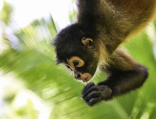
Belize has a rich variety of wildlife because of its unique position between North and South America and a wide range of climates and habitats for plant and animal life. Belize’s low human population and approximately 22,970 square kilometres (8,867 sq mi) of undistributed land make for an ideal home for the more than 5,000 species of plants and hundreds of species of animals, including armadillos, snakes, and monkeys [Need Images]. The Cockscomb Basin Wildlife Sanctuary is a nature reserve in south-central Belize established to protect the forests, fauna, and watersheds of an approximately 400 km2 (150 sq mi) area of the eastern slopes of the Maya Mountains. The reserve was founded in 1990 as the first wilderness sanctuary for the jaguar and is one of r the premier sites for jaguar [Need Image] preservation in the world.


(From top) Scarlet macaws [Need Image] are native to Central and northern South America.
Useful Links
Background

Rainforest covers nearly 60% of Belize’s land territory – down from 75% in late 1980.
Belize is a Caribbean country located on the northeastern coast of Central America. Belize is bordered on the northwest by Mexico, on the east by the Caribbean Sea, and on the south and west by Guatemala. The area of the country totals 22,960 square kilometres (8,865 sq mi), an area slightly larger than El Salvador, Israel, New Jersey or Wales.
While over 60% of Belize’s land surface is covered by forest, some 20% of the country’s land is covered by cultivated land (agriculture) and human settlements. Belize had a 2018 Forest Landscape Integrity Index mean score of 6.15/10, ranking it 85th globally out of 172 countries. Savanna, scrubland and wetland constitute the remainder of Belize’s land cover. Important mangrove ecosystems are also represented across Belize’s landscape. Four terrestrial ecoregions lie within the country’s borders: Petén-Veracruz moist forests, Belizian pine forests, Belizean Coast mangroves, and Belizean Reef mangroves.
Belize is also a leader in protecting biodiversity and natural resources. According to the World Database on Protected Areas, 37% of Belize’s land territory falls under some form of official protection, giving Belize one of the most extensive systems of terrestrial protected areas in the Americas.
A remote sensing study conducted by the Water Center for the Humid Tropics of Latin America and the Caribbean (CATHALAC) and NASA, in collaboration with the Forest Department and the Land Information Centre (LIC) of the government of Belize’s Ministry of Natural Resources and the Environment (MNRE) and published in August 2010 revealed that Belize’s forest cover in early 2010 was approximately 62.7%, down from 75.9% in late 1980.
A similar study by Belize Tropical Forest Studies and Conservation International revealed similar trends in terms of Belize’s forest cover. Both studies indicate that each year, 0.6% of Belize’s forest cover is lost, translating to the clearing of an average of 10,050 hectares (24,835 acres) each year. The USAID-supported SERVIR study by CATHALAC, NASA, and the MNRE also showed that Belize’s protected areas have been extremely effective in protecting the country’s forests. While only some 6.4% of forests inside of legally declared protected areas were cleared between 1980 and 2010, over a quarter of forests outside of protected areas were lost between 1980 and 2010. As a country with a relatively high forest cover and a low deforestation rate, Belize has significant potential for participation in initiatives such as REDD+.

A map of Belize’s National Protected Areas, including the 17 forest reserves.